В спор метрология позволява индустриални потребители, например в автомобилната промишленост и въздухоплавателни средства, за измерване на големи компоненти с точност до отклонения в стотна-мм обхват и обработка на данни директно в CAD системи. Продуктовата си гама включва лазерна следа, графични системи за обработка и висока точност промишлени тотални станции, заедно с една по-актуална спектър от софтуер, който може да комуникира с всички търговски продукти CAD
В метрология дивизия на Leica Geosystems поддържа конкурентно предимство чрез индустрията доказа своята технология за предоставянето на реален резултатите отдолу линия по-ефективни процедури за измерване, по-добре изработена крайните продукти, като по този начин значително намаляване на производствените разходи.
В метрология дивизия на Leica Geosystems, част от Шестоъгълник метрология, предлага най-изчерпателна продуктова линия в преносимите бизнес метрология, с аксесоари и състоянието на най-съвременните софтуер, за да разшири размера и капацитета на приборите. В Leica Geosystems Лазерни Tracker семейството на метрологията продукт е предназначен за преносими координира измерване. Нашите лазерни следа предлагат най-бързият цикъл на измерване в индустрията за високи точка плътност и най-дълго разстояние за измерване на голям обем работа до 40 метра (131 фута). Местни позициониране технология - Leica T-сонда, една "разходка-Around" безжични и невъоръжен CMM дава възможност за точно измерване на положението и ориентацията (6 степени на свобода) на всеки обект в космоса. В Leica T-сонда може да проверява и мярка почти всичко и навсякъде благодарение на уникалната си способност да се измери в рамките дълбоко части и инструменти. Leica T-сканиране е друга част на преносими решение CMM. Leica T-Сканиране digitizes сложни повърхности (от тъмно към метален без нужда от разпрашаване) с neglibible пъти настройка за последваща проверка и обратен инженеринг, и не пропуска околната среда light.Theodolite системи-Leica Geosystems Общо станции въвеждат точност до магазина етаж в тежката промишленост и други области, където стабилността и високо качество трябва да върви ръка за ръка. Електро-оптични теодолити са създали световни стандарти в никаква форма на оптична прецизност привеждане в съответствие за спътници и аксесоари aircraft.Hardware най метрология дивизия предлага богат избор от рефлектори и аксесоари за създаване на нови размери на следа Leica Geosystems лазер, скенери и теодолити. - На Leica Geosystems Axyz софтуер позволява на пълна интеграция на теодолити, тотални станции и следа лазер в производствения процес на фирмата. Софтуерът работи в тандем с Leica Geosystems Лазерни следа. Данните от измерванията могат да бъдат лесно достъпни с адаптивни инструменти доклад поколение. Софтуерът позволява множество сензори, за да работят едновременно или самостоятелно в рамките на една и съща или различни 3D координатна система (и).
- С новия Leica Geosystems Tracker интерфейс за програмиране на модули за всяко софтуерно приложение могат да бъдат създадени за цялостен контрол на Leica Geosystems Лазерни Следи от световни стандарти индустрия като Excel, Word, достъп или Visual Basic. Системата е независима от платформата работа, било то Windows, Unix, Linux и други. Програмирането, както и интерфейс на лазера следа се е отворена архитектура за създаване на модули за CAD / CAM / CAE софтуер прилагане.
Metrolog XG за Leica-Глобалната 3D софтуер за проверка е стандарт за измерване на приложения в автомобилостроенето, космонавтиката и общата индустрия точност. Metrolog XG взаимодействие Leica на Leica Geosystems PCMM Лазерни Tracker и Leica T-сонда и Leica T-сканиране. В допълнение, повече от 50 интерфейси за CMMS и PCMMs са на разположение. Графичната визуализация осигурява директна връзка на виртуални всички неутрални и родния формат CAD. Мощна функция за измерване базирани инструмент, пълен GD & T двигател, адаптивни отчитане и прост и бърз език за програмиране, поддръжка и опростите сложни събрание и процеси инспекция. Metrolog XG за Leica е наличен на 14 езика и подкрепя WinXP и Win2000.
InnovMETRIC Водещият продукт, PolyWorks, е мощен софтуер, който използва висока плътност точка облаци за измерване и контрол на качеството на отливките / умира / форми, както и да одобри производствените процеси чрез прототип, от една страна-член, произведени и сглобени части инспекция. PolyWorks предлага пълен набор от инструменти за сравняване на форми и профили (част към част и част към CAD) и включва най-пълна GD & T възможности анализ на пазара, както и най-широка гама от меки оценяващи инструменти (линейни , радиус, вълни & празнина, дебелина и т.н.). Всички качествени задачи за контрол може да бъде напълно автоматизиран и се извършва с едно кликване на мишката използва мощни скриптове PolyWorks "език. PolyWorks предлага уникален модул обратно инженерство, която произвежда клас А многоъгълни модели и бързо повърхности NURBS, които са изнесени за всяка CAD / CAM / CFD / софтуер за някакви тех-строги приложения производство.
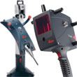
Portable CMM
Интересувате ли се от измерване и сондиране на мащабни обекти и монтаж шаблони в авиационната и автомобилната индустрии, точно там на място? Нов 3D решения, като 6DoF устройство за автоматично приложения, Leica T-Mac, на невъоръжен и безжични Leica T-сонда и с висока скорост ръка скенер Leica T-Scan направи всичко възможно!
Metrology Application Overview brochure
Click on our logo to view this Catalog


")
")


 +41/627376767